Some Chicago Boyz know each other from student days at the University of Chicago. Others are Chicago boys in spirit. The blog name is also intended as a good-humored gesture of admiration for distinguished Chicago School economists and fellow travelers.
Comments are closed.
Lovely. Thanks for sharing.
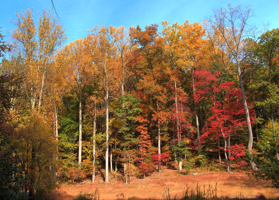
Sigh. Lovely. Pure lovely. So ephemeral … I loved those autumns in Ogden, Utah, where for a couple of brief weeks, the aspens all flamed up in pure gold, and the groves of them all looked like how I imagined the groves of Mallorn trees looked, in Lord of the Rings – silver trunks, and golden leaves, and a carpet of fallen golden leaves on the ground.
And then, it would snow, in a couple of weeks.
nice photos. in these parts, that would be a creek
Same here. Until it rained. Then it would be a river.
> And then, it would snow,
There is already snow on the peaks around Logan ;) As a rule, I count on snow in the valley by the third week of November.
> in these parts, that would be a creek
In the West, creeks are called rivers. In the East, hills are called mountains.
How’s the trout fishing ? I see a couple of interesting spots.
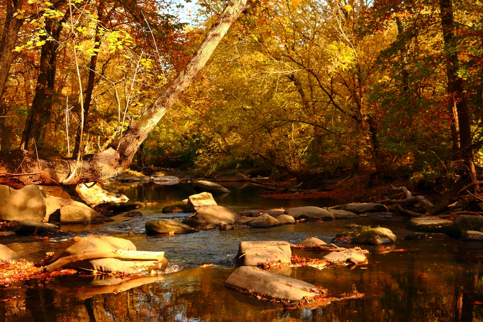
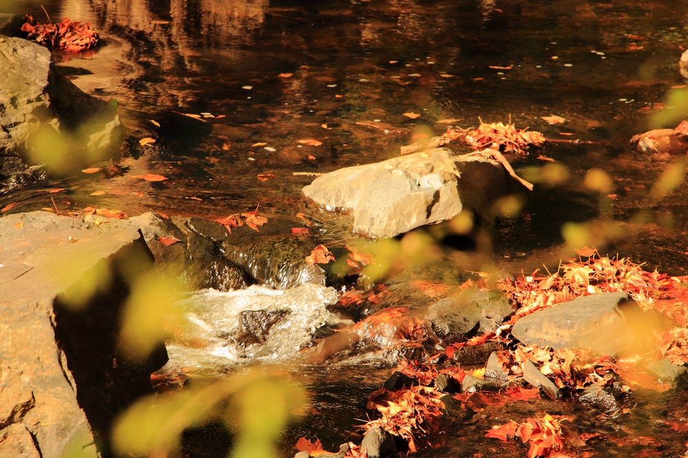
These photos were taken near to the top (head) of the Patuxent River watershed. The Little Patuxent is one of the tributaries that flow into the Patuxent. Yes, it’s very much creek size.
If you look carefully at the first photo, you’ll just be able to discern that I photographed over a series of low cascading falls, each about a foot high. There were a few more behind me and more of them a little further down river. You can find each fall because the granite bedrock crops out as a series of blocks inline across the river. When a river is changing gradient fairly rapidly it often forms a ‘pool and riffle’ sequence. I don’t understand the hydrodynamics that cause it, but it’s a well know phenomenon. It doesn’t always occur, sometimes there’s a single large falls, or a pair, but pool and riffle is common.
All along the East Coast there are a series waterfalls where the Appalachian Piedmont meets the coastal plain. It’s called the Fall Line. Rivers and creeks cut themselves down to bedrock due to the sharp change in land elevation over a fairly short distance. And the Piedmont is underlain by very hard crystalline rock that doesn’t erode easily. Colonial cities were often established near the Fall Line because the colonists could place a water mill in a canal adjacent to the falls (high change in water gradient over a short distance) and because the rivers were often navigable just below the falls. DC is just above the Fall Line. Baltimore and Philadelphia were founded just below it, so both those cities have navigable harbors.
Mike, not a fisherman, so I’m not the person to ask. Also, there’s a small reservoir a ways downstream and bass and pike are to be had, but this is not a wild river. However, I believe they stock trout in the streams around here.
I see a couple of pools that might, depending on water temperatures, harbor trout. Long ago, before I got involved in sailing, we used to fish small pools in an urban river (The San Gabriel) and there were large brown trout hiding there that ate the stocked trout. It kind of looked like that one.
Very pretty. In my childhood that would have been a “burn” or “water” i.e. Patuxent Burn, or Patuxent Water, or Water of Patuxent. On the other side of the border it would probably have been Patuxent Beck.
Since Englishmen wouldn’t typically understand that use of “water” you’d find it explained to them as, for example, “Kirtle Water is a stream in Scotland”.
The only local use I can remember for “creeks” was for small streams by the shore. The creeks would vanish, or vastly widen, at high tide.
Come to think of it, the only seaside “creek” near us that was referred to by name was referred to as the “pow”. Maybe “creek” was an import; boys will read books, eh?
@Michael Hiteshew
Washington, DC is below the fall line, below Great Falls; hence, the establishment of of Georgetown, where the Chesapeake and Ohio Canal commenced.
In 1814, the British forces landed near the mouth of the Patuxent, and marched on Washington.
Georgetown was a port, but it would not have been fun to get a square-rigged ship up the river at to that point, owing to its narrowness. Alexandria much more practical for docking oceangoing vessels.
Richard, you are correct. My mistake. Thanks.
Map: https://www.google.com/maps/place/Great+Falls+Park/@39.0009454,-77.3058445,10z/data=!4m2!3m1!1s0x89c2fdc8b4b9259b:0x64e8543b7d78dbfa
These are absolutely lovely Michael Hiteshew! Thank you so much for sharing! Signed~ your Proud Sister!